東京の台地 – 武蔵野台地
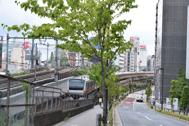
If you take a Japan Railway (JR) Chuo Line train ( rapid service ) bound for Ome ( that is to say, westbound ) at Tokyo Terminal, soon you will meet the eastern extremity of Tokyo’s plateau at Ochanomizu Station (the 2nd stop).
/ 東京駅からJR中央線(快速)に乗り、青梅(おうめ)に向かう(西の方角に進む)と、程なく、始発駅から2つ目の駅、御茶ノ水で、東京の台地の東端に出会う。
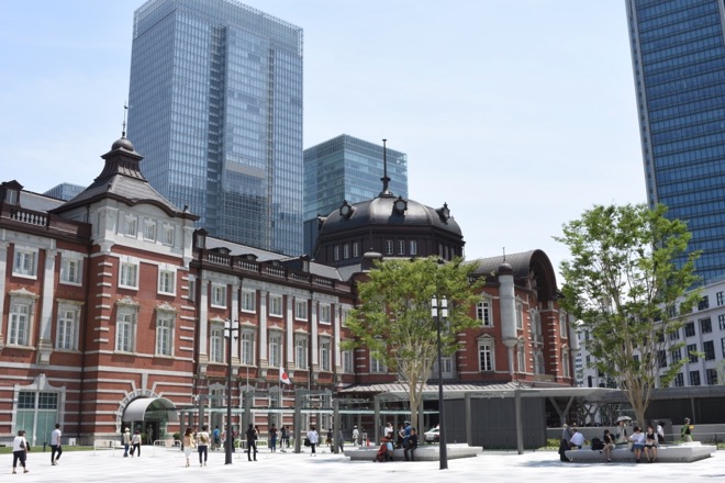
Tokyo Terminal / 東京駅
Elevation 10-13 ft / 標高 3-4 m
A JR Chuo Line train bound for Ome ( rapid service )
“Chuo” means “central”.
Note the orange color of the train.
JR中央線快速青梅行きの車両
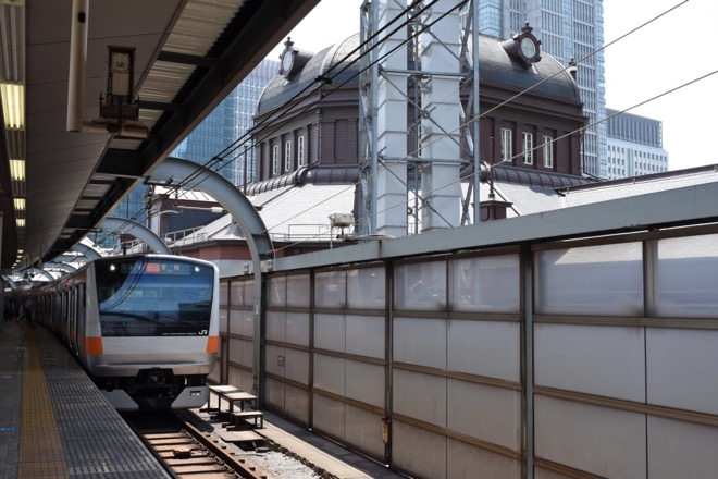
A Chuo Line train moving toward Ochanomizu Station photographed from the direction of Tokyo Terminal ( in the vicinity of Kanda Station the 1st stop).
御茶ノ水駅に向かう中央線の車両(神田駅付近で撮影)
Elevation in Kanda area 15-16 ft / 神田駅付近の標高 4-5 m
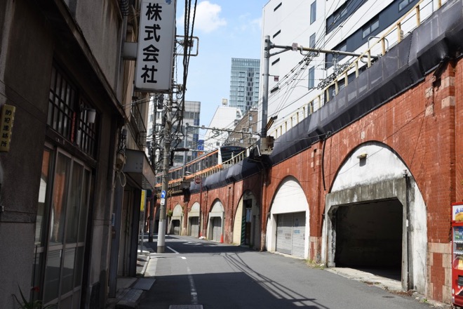
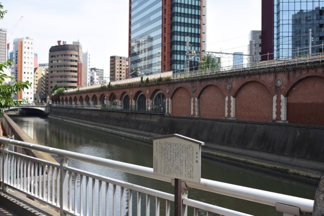
The same elevated railway viewed from the opposite side, photographed from the direction of Ochanomizu Station. Kanda River, which is tidal in these vicinities, is seen in the foreground. The notice board explains the history of Shohei-bashi Bridge to the right, which the photographer is about to cross.
同じ高架を、線路の反対側で、御茶ノ水駅方向から撮影。前景は神田川。この付近は汽水域で、潮の満干の影響を受ける。立て札は、これから渡ろうとしている、撮影者の右手にある「昌平橋」の由来を説明している。
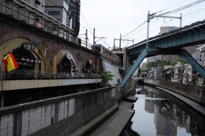
The photographer is now on Shohei-bashi bridge and looking the other way toward Ochanomizu Station. A Chuo Line train which has just left Ochanomizu for Tokyo is seen.
昌平橋の上に移動し、反対側の御茶ノ水駅方向を撮影。御茶ノ水駅を出て東京駅に向かう中央線の車両が見える。
Elevation of the photographer’s position remains the same. / 撮影位置の標高は前と同じ。
Having crossed Shohei-bashi Bridge and passed under the elevated railway, the photographer now looks up the direction of Ochanomizu Station from the other side of the railway. Notice the sloped roadway to the top of the plateau becomes on the way higher then the elevated railway.
昌平橋を渡り、高架の下を通って、線路の反対側から御茶ノ水駅方向を見る。台地に登る坂道が、途中から、鉄道の高架より高くなることに注目。
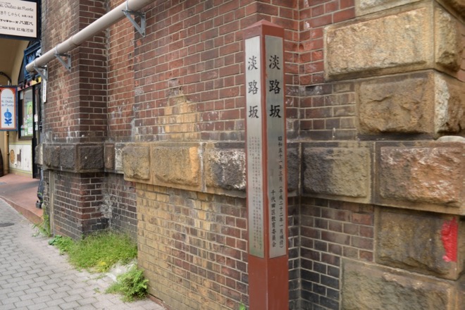
The name of the slope is “Awaji-zaka” ( “淡路坂”). “坂”, which is pronounced as “Saka” or “Zaka”, means “slope”. The signpost explains the name of the slope and its origin. / この坂は、淡路坂と呼ばれている。坂の名とその由来を記した道標がある。
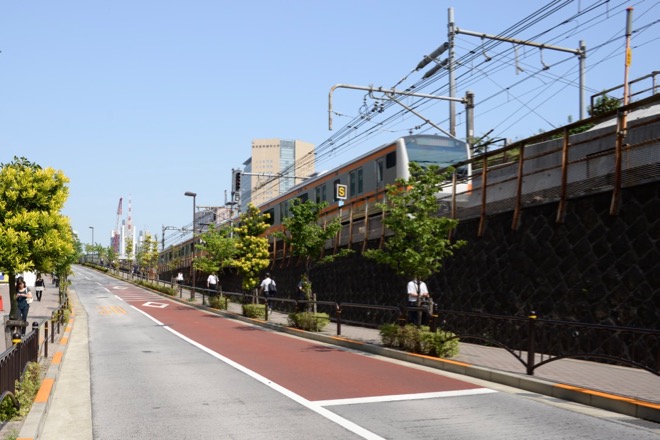
The photographer looks back from near the top of the slope toward the direction of Shohei-bashi Bridge ( ,which is not visible in this picture, as it is situated on the other side of the railway). Notice an orange colored Chuo Line train approaching above a pedestrian. Also notice, however, at the photographers position, its railroad is below the ground.
坂の上近くで振り返り、昌平橋方向を見る(橋は線路の向こう側にあり、この写真では見えない)。歩行者の頭上にオレンジ色の中央線の車両が近づいているのが見える。しかし、その線路は、撮影地点では、地面よりも低くなっている。
The building of Ochanomizu Station is situated at the top of the slope, that is to say, on the plateau. The platforms are located downstairs, because, as we have seen, the hight of the railways does not reach that of the plateau.
The roadway to the right of the station, along which two white cars are standing, is a bridge named Hijiri-bashi Bridge, which crosses the fosse in which the railway and Kanda River run.
御茶ノ水駅の駅舎は、坂の頂上、すなわち台地上にある。ホームは階下にあるが、その理由は、すでに見たとおり、線路の高さが台地の高さに満たないからである。
白い車が2台停まっている、駅舎の右手の道路は、線路と神田川のある掘割を越える、聖橋である。
Kanda River and the platforms of Ochanomizu Station viewed from Hijiribashi Bridge. The people on the platform are waiting for a JR Chuo Line train for Tokyo to arrive. Above its roof, you may be able to recognize roadside trees along Awaji-zaka slope on the plateau.
The red train emerging from the tunnel below to cross Kanda River is of Tokyo Metro ( subway ) Marunouchi Line.
Yellow trains are of JR Sobu Line, which connects Tokyo’s plateau in the west, Tokyo’s flat lowland in the east and the plateteau in Chiba Prefecture adjoining it in the east.
The small bridge over Kanda River below the highly elevated iron bridge of Sobu Line is Shohei-bashi Bridge we have just seen.
聖橋の上から、神田川、御茶ノ水駅のホームを見る。ホーム上に、東京行きの中央線を待つ人々の姿が見える。その屋根の上方には、台地の上の淡路坂沿いの街路樹が見える。
下方のトンネルを出て、神田川を渡ろうとしている赤い列車は、東京メトロ(地下鉄)丸の内線である。
黄色の列車は、JR総武線。東京西部の台地、東京東部の低地、その東方でこれに隣接する千葉県内の台地を結ぶ路線である。
神田川を渡る高架鉄橋の下方に見える小さな橋は、先刻渡った、昌平橋。
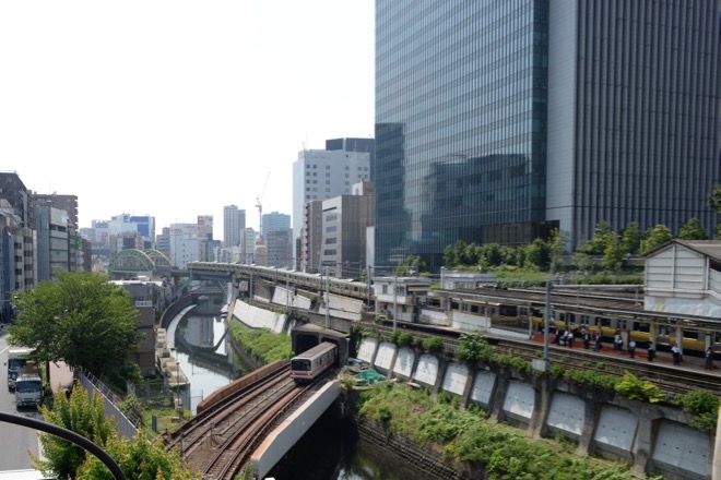
The elevation of the plateau on which Ochanomizu Station is located is as high as 60 feet, some 50 feet higher than the flat lowland on which the previous two stations ( Kanda and Tokyo ) and Shoheibashi bridge are situated. / 御茶ノ水駅の駅舎の建つ台地の標高は、約18メートルで、直前の2つの駅(神田駅、東京駅)や昌平橋がある低平地より、15メートルも、高くなっている。
The map below shows the major stations along JR Chuo Line. It also shows the relative height of particular points by its coloring. That is to say, the elevation becomes lower in order of brown, yellow, green, light blue and navy blue. / 下の地図は、JR中央線の主要駅を示したものである。また、この地図の彩色は、その場所の相対的な高さを示している。すなわち、茶色、黄色、緑色、水色、紺色の順に、その場所の標高が低くなる。
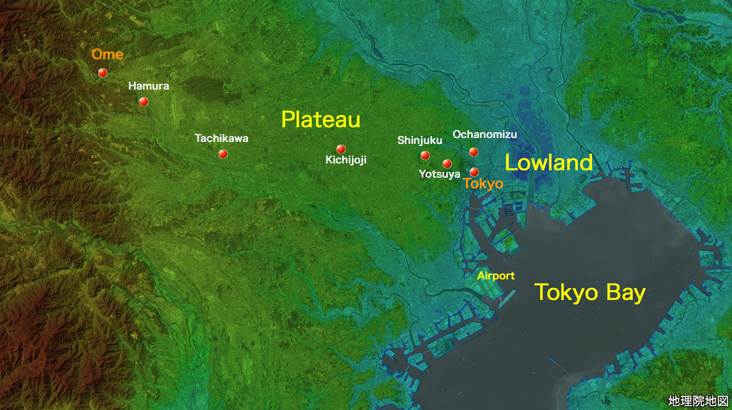
地図の出典:国土地理院ウェブサイト「地理院地図」(「航空写真(単色)」と「色別標高図」を重畳。注記は編者による。)/ Source of the map : GSI Map, the Government of Japan ( The monochromatic aerial photograph and the “Irobetsuhyokozu” [ hereinafter referred to as “colored elevation map” ] superimposed. The marks and the remarks are added by the editor )
The railway of Chuo Line runs at first in a large “S” shaped line starting from Tokyo Terminal, all the way till it passes Shinjuku Station. After that, however, it runs in a straight line to the west up to Tachikawa Station. Meanwhile, from Ochanomizu onward, it consistently runs on the plateau, occasionally, though, passing valleys or rivers within the plateau, or passing through cuts and tunnels where its height does not reach that of the plateau. By the way, the line beyond Tachiwa through Ome till Okutama is a branch line of Chuo Line named Ome Line, to be exact. Furthermore, it runs northwest, instead of due west. / 中央線は、東京駅を出てから、新宿を過ぎるまでは、大きなS字を描いて蛇行する。しかし、その後は、立川に至るまで、一直線に西進する。また、御茶ノ水から先は、一貫して台地の上を進む。ただし、途中、台地内の谷や川を渡ることや、線路の高さが台地の高さに及ばない場合に、切り通しやトンネルを通って進むこともある。なお、立川から青梅、その先の奥多摩までの区間は、正確には、青梅線と呼ばれる、中央線の支線である。進行方向も、真西ではなく、北西である。
The plateau, as a whole, is called Musashino Daich or Musashino Plateau, whose eastern extremity being also called Yamanote or Yamanote Daichi. Furthermore, individual, smaller parts of Yamanote Plateau devided by valleys have been given respective proper names such as, for example, Suruga-dai or Hongo-dai ( Dai(台) means a plateau.). On the other hand, the flat land of low elevation to the east of the plateau, where Tokyo Terminal and Kanda Station are located, is called Tokyo Lowland or Shitamachi Lowland. / 台地は、その全体を、「武蔵野台地」と呼ばれている。また、その東縁は、「山の手」又は「山手台地」とも呼ばれる。さらに、谷[複数]で隔てられた、より小さな、その構成部分にも、例えば「駿河台」、「本郷台」といった、個別の名が付けられている(「台」とは、台地のことである。)。これに対し、台地の東側に隣接する、東京駅や神田駅の所在する、標高の低い平地は、「東京低地」又は「下町低地」と呼ばれている。
The elevation of Musashino Plateau increases steadily as you proceed to the west. This can be shown by the elevation of the stations along Chuo Line. They are, respectively from the east, ( 10 – 13 feet at Tokyo and Kanda in the Tokyo Lowland – outside the plateau), 60 feet at Ochanomizu, 100 feet at Yotsuya (the 3rd station), 130 feet at Shinjuku (the 4th station), 180 feet at Kichijoji, 280 feet at Tachikawa, 460 feet at Hamura and 650 feet at Ome (the destination). / 武蔵野台地の標高は、西に進むにつれ、次第に高くなる。これを、中央線の駅の標高でみると、東から順に、(東京及び神田[台地外の東京低地]3〜4メートル)、御茶ノ水(台地東縁)18メートル、四谷(台地上。以下同じ。)30メートル、新宿40メートル、吉祥寺55メートル、立川85メートル、羽村145メートル、青梅200メートルとなっている(数値は地理院地図で計測した概数)。
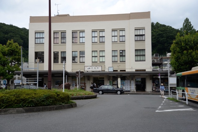
Ome Station ( the destination ) is approximately 30 miles away from Ochanomizu Station along Chuo Line and it takes about 80 minutes for a rapid service train to cover the distance.
青梅駅は、御茶ノ水駅から、距離約50キロメートル、所要時間約80分の地点にある。
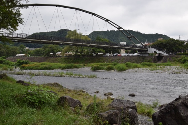
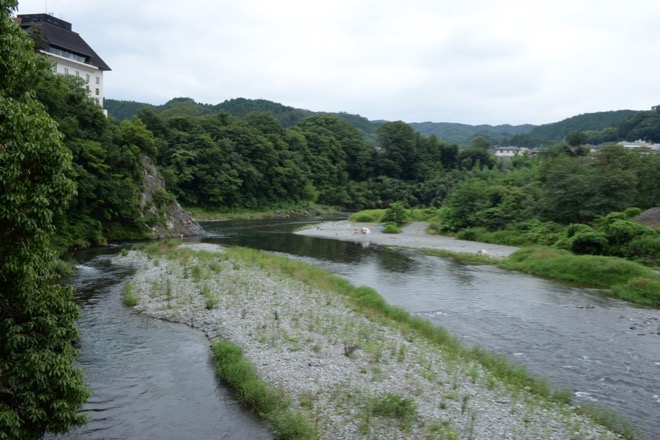
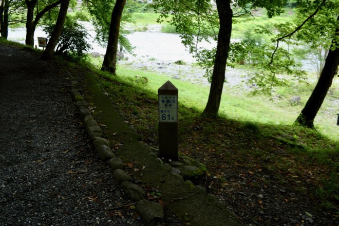
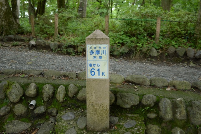
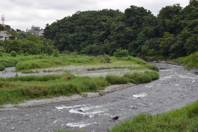
Some fifteen minute walk to the south from Ome Station will lead you to the left bank of Tama River ( Kamanofuchi Park ) . Cross the bridge onto the right bank, and there you will find a signpost which tells you that you are 61 kilometers ( 37 miles ) away from the mouth of the river on Tokyo Bay. / 青梅駅から南に15分程歩くと、多摩川左岸(釜の淵公園)に出る。橋を渡って右岸に出ると、そこには、その場所が、東京湾岸の河口から、61キロメートル上流に位置することを示す、河川管理当局の標識が設置されている。
Previous overview
# 1 Mt.Fuji – the father of Tokyo’s plateau / 富士山 – 東京の台地の父
This overview
# 2 The plateau – “Musashino Daichi” / 東京の台地 – 「武蔵野台地」
More Overviews
# 3 Tama River – the mother of Tokyo’s plateau / 多摩川 – 東京の台地の母
# 4 Maps & Geography / 地図と地理