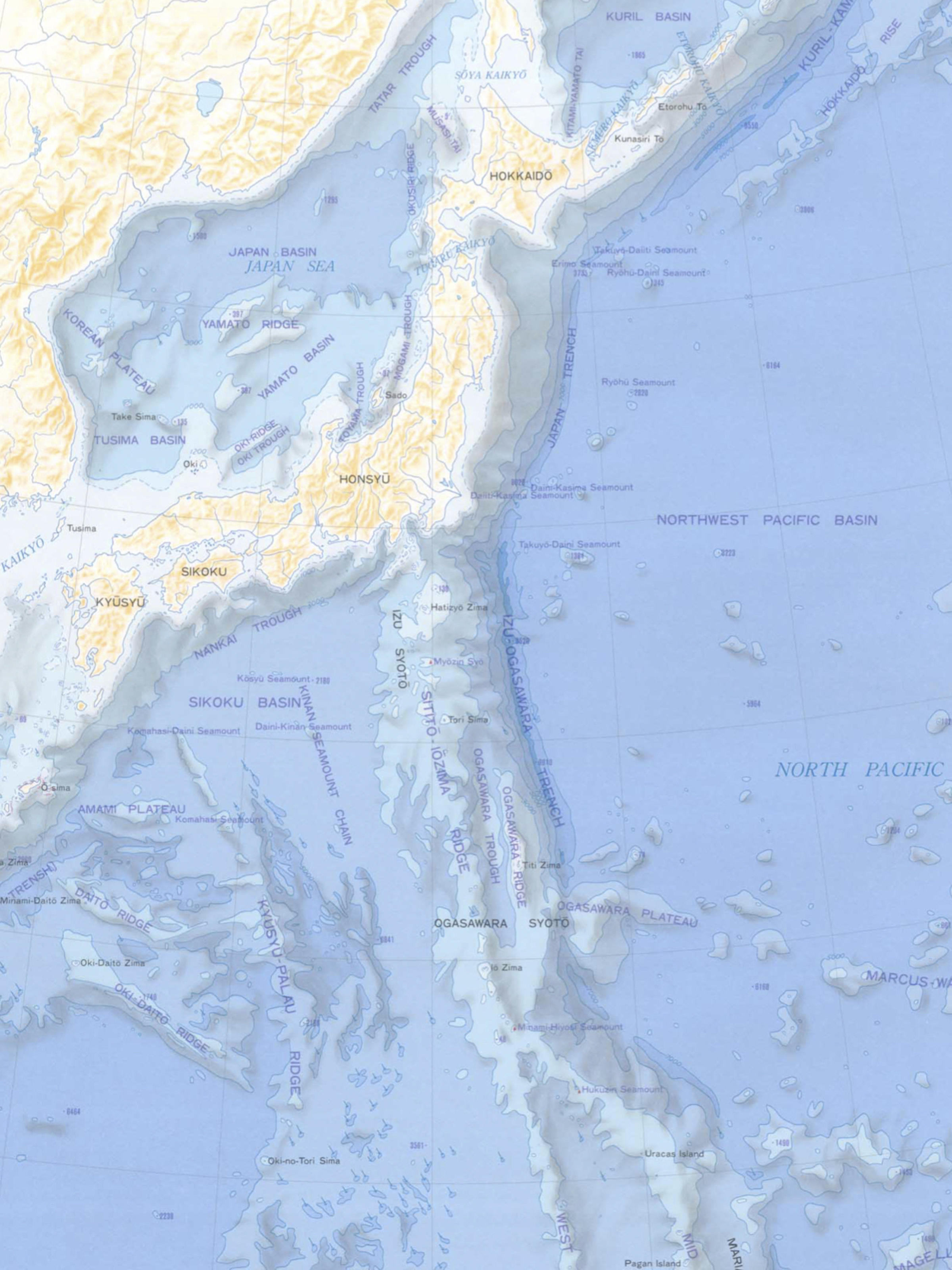
– 日本周辺のプレートテクトニクス –
The periphery of the Japanese archipelago is a unique place where three subduction zones of oceanic plate, two volcanic fronts and three island arcs meet. / 日本列島周辺は、3つの沈み込み帯、2つの火山フロント、3つの島弧が出会う、ユニークな場所である。

Submarine terrain around Japanese archipelago / 日本列島周辺の海底地形
地図の出典:国土地理院ウェブサイト「新版日本国勢地図(1990年)」(当サイト編者にてトリミング) / Sorce of the map : GSI web site
1. Subduction of oceanic plate / 海洋プレートの沈み込み
There are three subduction zones of oceanic plates in the southeast of Japanese archipelago.→ Read more about the subduction / 日本列島の東南には、三つの海洋プレートの沈み込み帯がある。→ プレートの沈み込みについて、もっと読む。
2. Volcanos and volcanic front / 火山と火山フロント
An oceanic plate which subducted causes its upper plate to have volcanos and a volcanic front. → Read more about volcanos and volcanic front. / 沈み込んだ海洋プレートは、上盤のプレート上に、火山[複数]、火山フロントを生じさせる。→ 火山、火山フロントについて、もっと読む。
3. Collision with the Izu arc / 伊豆弧との衝突
Since 15 million years ago, the Izu-Ogasawara arc, which is situated to the south of the Japanese archipelago, has been colliding with the main island of Japan ( Honshu ). This has made the midland Honshu place where three arcs ( the northeastern Japan arc, the southwestern Japan arc and the Izu arc) meet. → Read more about the collision. / 1500万年前から、日本列島の南にある伊豆・小笠原弧が、日本列島(本州)に衝突している。これにより、本州中央部は、三つの弧(東北日本弧、西南日本弧、伊豆弧)が出会う場所となった。→ 伊豆弧との衝突について、もっと読む。
4. Accretionary prisms – the base of the Japanese archipelago / 付加体〜日本列島の基盤
Masses of rock which include surface materials on the ancient deep-sea floor left behind by the subducting ( that is to say vanishing into the mantle ) oceanic plate make up the base of the Japanese archipelago. Such masses are called accretionary prisms. → Read more about accretionary prisms. / 沈み込んで失われた海洋プレートが残していった大昔の深海底の表層部を含む岩塊が、日本列島の基盤をなしている。それらの岩塊は、付加体と呼ばれている。→ 付加体について、もっと読む。
