
Imperial Palace (Kokyo) and Edo Castle (Edojo)
The map below is the partial enlargement of the colored elevation map of downtown Tokyo in the previous page. The place surrounded by moats in the center of the map is the Imperial Palace ( Kokyo ), the former Edo Castel ( Edo-jo ). For comparison, two aerial photographs of the same district are also shown below. / 下の地図は、前ページのデジタル標高地形図「東京都区部」から、皇居周辺部を切り出したものである。中心部にある、濠で囲まれた場所が皇居(旧江戸城)。比較のため、同じ区域の航空写真2点を示した。
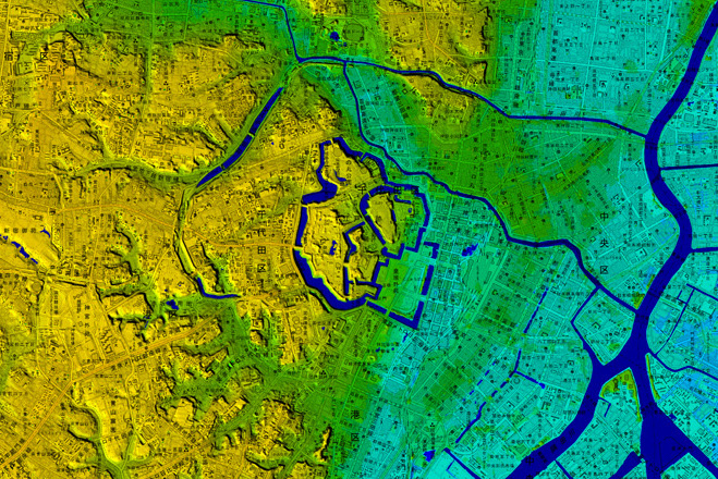
地図の出典:国土地理院ウエブサイト「東京都区部」(デジタル標高地形図)(当サイト編者において一部を切り出し加工) / Source of the map : GSI web site, Government of Japan
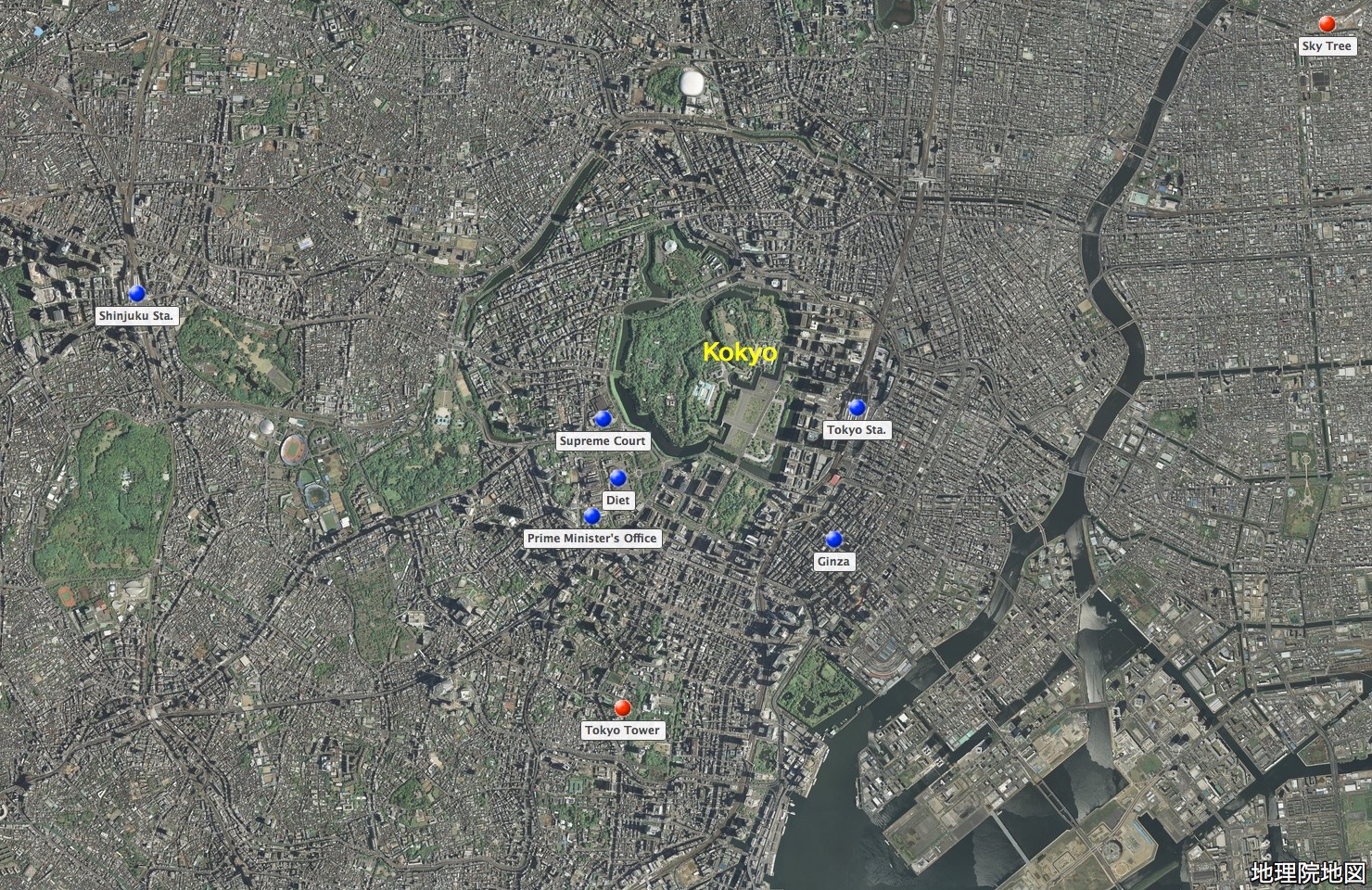
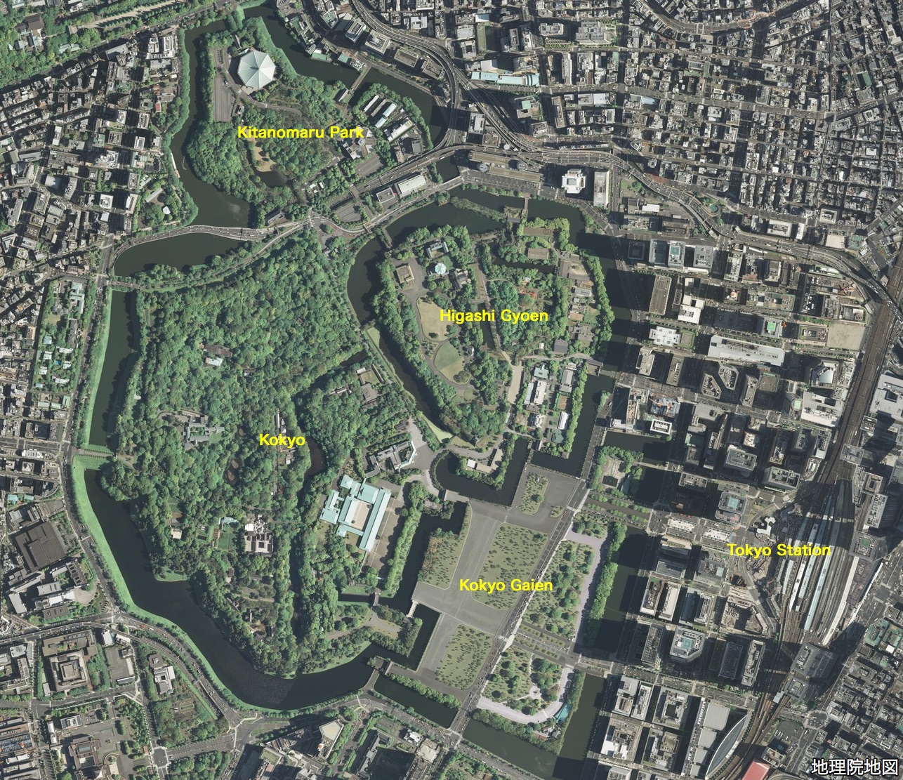
写真の出典:国土地理院ウェブサイト「地理院地図」(「航空写真」。注記は編者による。)/ Source of the map : GSI Map, the Government of Japan ( The marks and the remarks are added by the editor )
Chronology / 略年表
12th Century
It is thought that in the area of present-day Higashi Gyoen, Kokyo there was a residence of Shigenaga Edo, the head of a dominant family in the region.
15th Century
The feudal military commander Dokan Ota builds his castle ( Edo Castle / Edo-jo ) in the area of present-day Higashi Gyoen, Kokyo.
16th Century
In 1590, Ieyashu Tokugawa enters Edo-jo, assuming the lordship of six dominions of the Kanto region.
17th -19th Century
In 1603, receiving the title of Shogun from the Emperor, Ieyasu founds Tokugawa Shogunate, which thereafter would rule Japan for nearly three centuries. The years of Tokugawa Shogunate is called Edo period.
In 1867, the last Shogun resigns, returning his prerogatives to the Emperor.
In 1868, with the Meiji Restoration, Edo becomes Tokyo, the capitol of Japan and Edo-jo becomes the Imperial Palace.
12世紀
現在の皇居東御苑地区に、豪族江戸重長の居館があったと考えられている。
15世紀
太田道灌、現在の皇居東御苑地区に江戸城を築城。
16〜19世紀
1590 徳川家康、関東6カ国の統治者として江戸城に入る。
1603 徳川家康、征夷大将軍となり、江戸幕府を開く。
1867 大政奉還
1868 明治維新
東京の基礎は、1590年から1660年までの70年間に、徳川家及び徳川幕府が行った建設事業によって築かれた。これらの事業は、家康が江戸城に入った1590年から1603年までは、徳川家とその家臣たちの手によって行われ、家康が征夷大将軍の地位に就いた1603年からは、幕府の計画の下、将軍命による「天下普請」として、全国諸大名によって遂行された。