
– フォッサ・マグナ –
The red icons in the map below shows the locations of Itoigawa City and Sizuoka City, the both ends of Itoigawa-Sizuoka Tectonic Line (ISTL), which marks the western edge of Fossa Magna. The Japanese archipelago is thought to be divided by this line into two separate island arcs, which are the northeastern Japan island arc and the southwestern Japan island arc. As stated above, Fossa Magna is not a ( tectonic ) line ( which means a fault ) but a ( rift ) zone. Although there is consensus on the observation that the ISTL is its western edge, there is difference of opinion as to the location of the fault that marks its eastern edge.
下の地図の赤いアイコンは、フォッサマグナの西縁をなす「糸魚川・静岡構造線」(糸静線)の両端に当たる、糸魚川市と静岡市の位置を示したもの。本州は、この断層を境に、二つの島弧(「東北日本島弧」と「西南日本島弧」)に、分かれている。なお、フォッサマグナは、上記のとおり、線ではなく、帯である。その西縁が糸静線であることに異論はないが、東縁をなす断層の所在については、見解の相違がある。
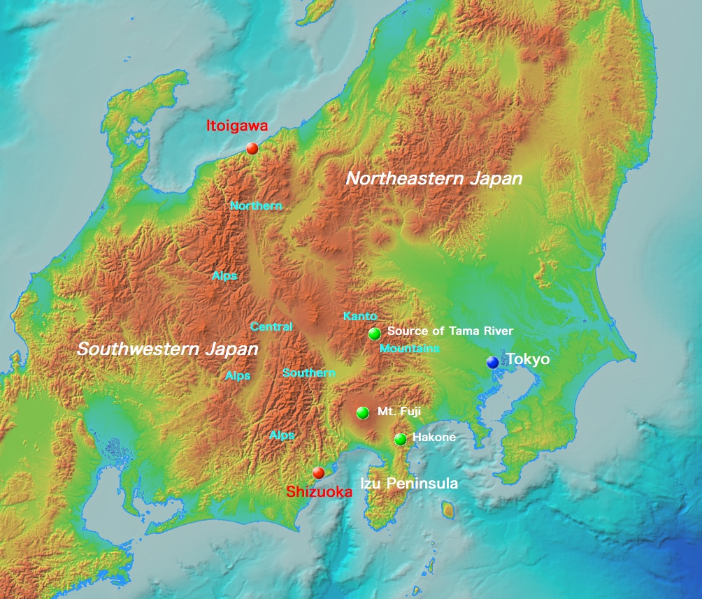
出典:地理院「地理院地図」(注記は編者による) / Source of the map : GSI Map, Government of Japan. The note are by this editor.