This overview
# 1 Mt.Fuji – the father of Tokyo’s plateau / 富士山 – 東京の台地の父
More Overviews
# 2 The plateau – “Musashino Daichi” / 東京の台地 – 「武蔵野台地」
# 3 Tama River – the mother of Tokyo’s plateau / 多摩川 – 東京の台地の母
# 4 Maps & Geography / 地図と地理
– The father of Tokyo’s plateau –
富士山 – 武蔵野台地の父
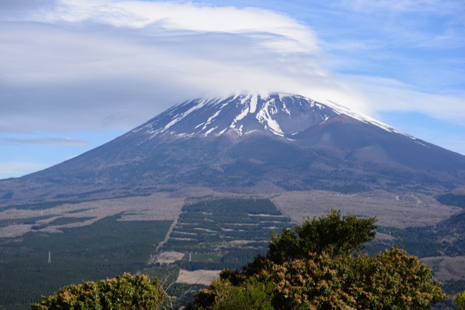
Mount Fuji photographed from the hillside of Mount Ashitaka. / 愛鷹山(中腹)から見た富士山。
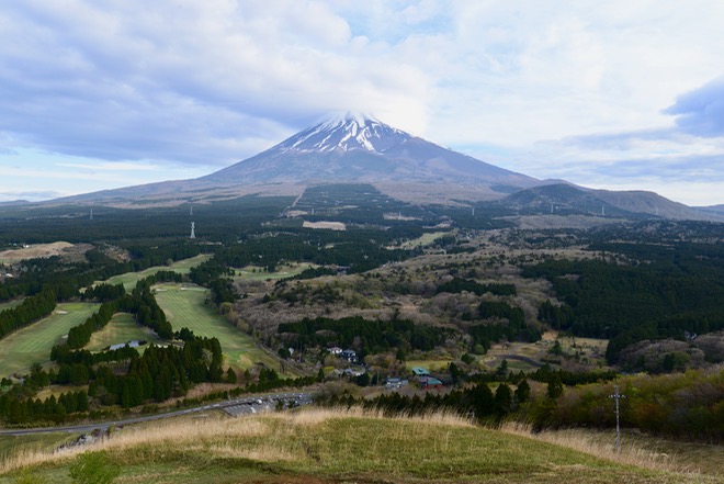
Mt.Fuji provided a thick layer of volcanic ash to the earth of Tokyo’s plateau. / 富士山は、東京の台地に、厚い火山灰の地層をもたらした。
Notice the reddish color of the earth of Mt. Ashitaka. The grey volcanic ash acquires this color as the iron it contains rusts. / 赤みを帯びた愛鷹山の土に注目。灰色の火山灰は、含有する鉄分が錆びると、このような色になる。
The picture below was taken in Tachikawa City, Tokyo, which is located in the western part of Tokyo’s plateau. As this shows, the earth of the plateau of Tokyo has the same color as that of Mt. Ashitaka. / 下の写真は、東京の台地西部にある、東京都立川市で撮影された。東京の台地の土は、写真のとおり、愛鷹山の土と同じ色をしている。
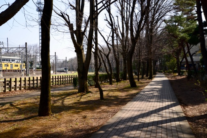
This is because the earth of the two places originates from the same past events – the volcanic activities of Mt. Fuji. / その理由は、どちらの土も、富士山の火山活動という、同じ過去の出来事に由来しているからである。
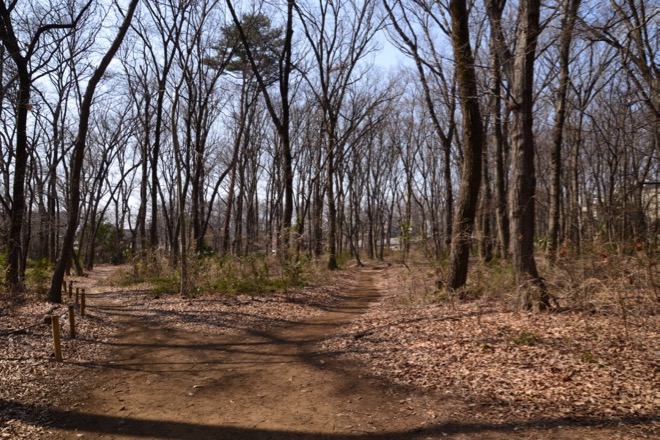
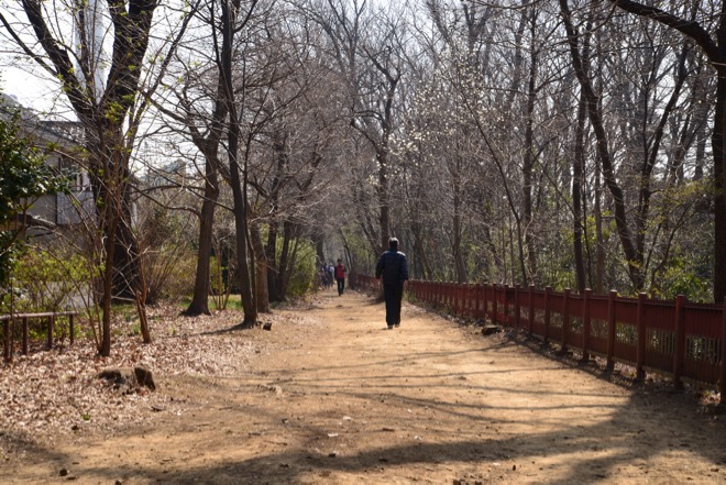
Shown by the pictures below taken in the same location in Tachikawa City are the Tamagawa-Josui waterworks and the greenway along it, which run across the Tokyo’s plateau. / 下の写真は、立川市の同じ場所で撮影された、東京の台地を横切る、玉川上水とその緑道である。
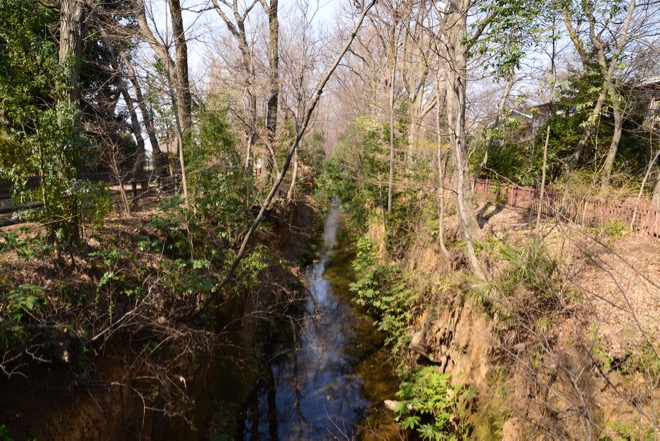
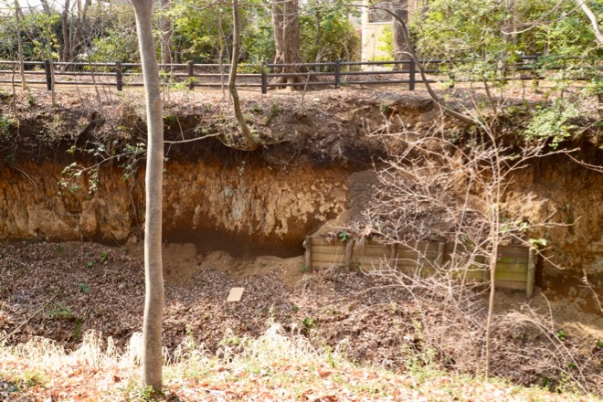
The cliff of the waterworks in the picture above gives you some idea of the thickness of the ash layer Mt.Fuji piled up onto the plateau of Tokyo, which is said to have reached 5 to 6 meters during the past 60 thousand years. / 上の写真の玉川上水の崖は、富士山が東京の台地の上に積もらせた火山灰の地層の厚さをイメージさせてくれる。それは、過去6万年の間に、5、6メートルに及んだという。
That is to say, each 1 meter thick ash layer in this picture represents the history of some 10,000 years. / つまり、この写真の地層は、厚さ1メートルあたり、約1万年の歴史を表しているということである。
The last eruption of Mt. Fuji took place some 300 years ago, in December, 1707. / 富士山の最後の噴火は、今から約300年前の1707(宝永4)年12月に起きた。
The record at that time ( Oritakushibanoki by Hakuseki Arai )tells us that even in Edo ( present Tokyo ), some 60 miles away from the volcano, thunder and lightning were observed and at first white ash, then black ash fell. It has been reported that the sky grew so dark that people had to use lanterns even during the daytime. The ashes are thought to have reached Edo rapidly, carried by the westerlies. The eruption lasted 16 days and it is estimated that the ashes piled up a quarter to a third inch thick in Edo. / 当時の記録(新井白石『折たく柴の記』)によれば、約100キロメートル離れた江戸(現在の東京)でも、雷鳴、稲妻が観測され、最初は白い灰が、次いで黒い灰が降ったという。また、空がたいへん暗くなり、日中でも行燈(あんどん)が必要になったと伝えられている。火山灰は、偏西風に運ばれ、速やかに江戸に飛来したと考えられる。噴火は16日間続き、江戸では、6〜9ミリメートルの火山灰が積もったと考えられている。
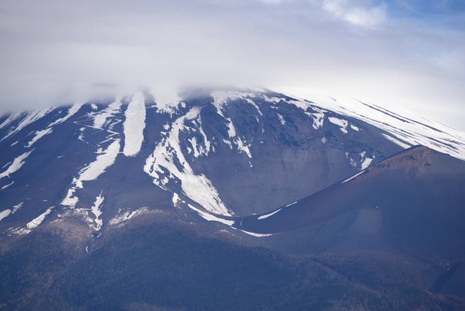
This picture is the enlargement of a part of the photograph of Mt. Fuji shown above. The big hollow and the mountain (Mt.Hoei) on the right side of the slope of Mt. Fuji shown here are the product of the said eruption. / この写真は、上の富士山の写真の一部を拡大したものである。ここに示された富士山の右側の斜面の大きな窪みと山(宝永山)は、この噴火によって出来たものである。
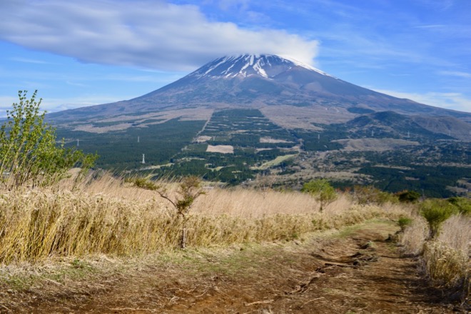
The mark “+” in the map below indicates the approximate location of the photographer of the pictures of Mt. Fuji in this page. The results of 1707 eruption can also be observed. / 下の地図は、上に掲げた富士山の写真のおおよその撮影位置を、「+」印 で示したもの。宝永噴火の痕跡も、確認することができる。
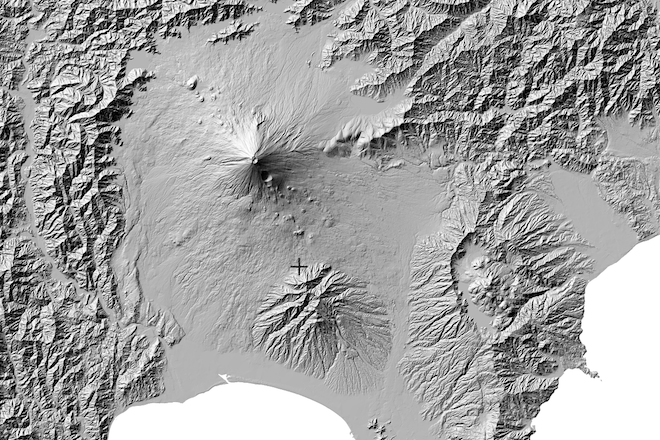
地図の出典:国土地理院ウェブサイト「地理院地図」(「陰影起伏図」に、同サイトの機能を用いて加工) / The source of the map : the internet web site of the Geospatial Information Authority of Japan (GSI) “ Chiriinchizu” ( hereinafter referred to as “GSI Map” ) (“ Ineikifukuzu ”( hereinafter referred to as “shaded elevation map”), with a mark added by the editor )
This overview
# 1 Mt.Fuji – the father of Tokyo’s plateau / 富士山 – 東京の台地の父
More Overviews
# 2 The plateau – “Musashino Daichi” / 東京の台地 – 「武蔵野台地」
# 3 Tama River – the mother of Tokyo’s plateau / 多摩川 – 東京の台地の母
# 4 Maps & Geography / 地図と地理